|
|
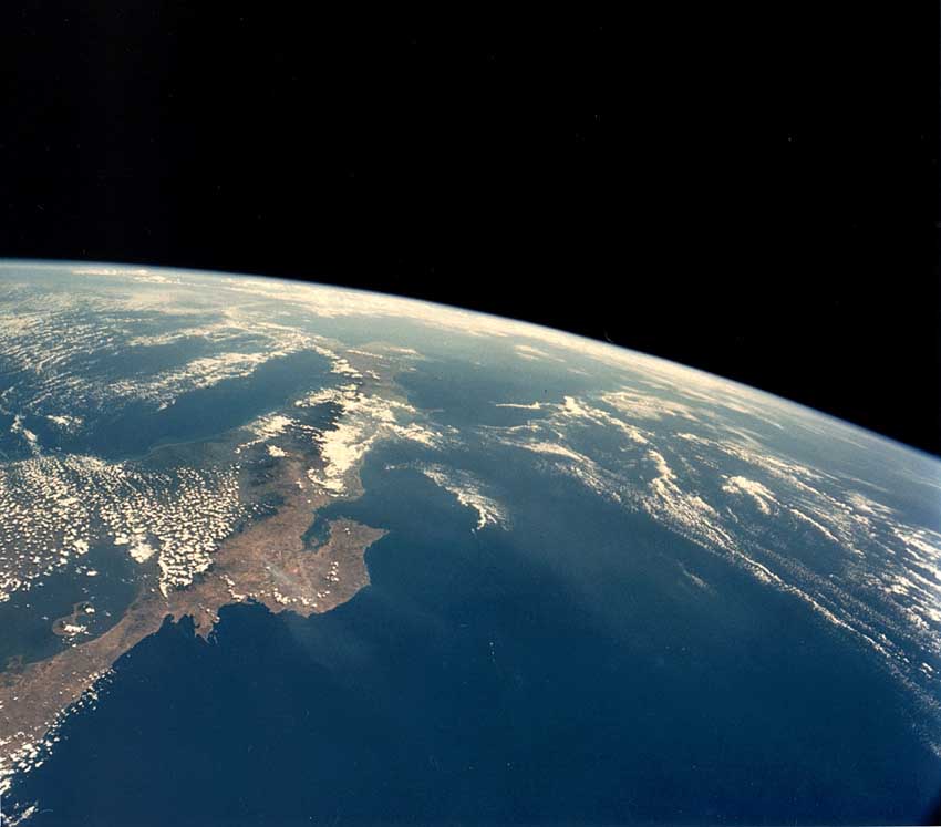 4 satellite view of ACG DHJanzen100003.jpg high resolution
|
|
| A vew of northwestern Costa Rica from the north to the south. Lake Nicaragua is the large body of blue water in the continent in the lower left. The Santa Elena Peninsula is the first large peninsula, with the much larger Nicoya Peninsula above it. The Area de Conservacion Guanacaste (ACG) encompasses the Santa Elena Peninsula and the area between it and the clouds, and extends well under the clouds. The mass of clouds in the eastern ACG is from the moist winds coming from the Caribbean and being uplifted (cooling, condensing) by the three volcanos (Volcan Orosi, Volcan Cacao, and the Volcan Rincon de la Vieja massif) in the eastern end of the ACG. The area described here matches the small green conservation area mapped in the upper northwestern corner of the map of Costa Rica (DHJanzen100004.jpg). | ||
back to lecture slides
or skip to: